The First Annual, Quarterly Lift Assisted Ride Report, Part III

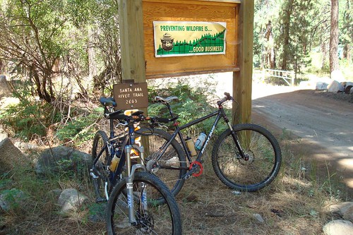
The bikes: ready to rock the SART… or is it ready to be rocked by the SART? We soon find out.
We jokingly considered buying lift tickets again for Sunday morning’s ride, but riding some of the best singletrack in So. Cal. was too tempting. After cleaning up the cabin and packing our stuff, we set off to visit the local bike shops in town… for umm… research. Then off to the trail.

Our trusty steed all loaded up waiting at the Visitor Info center
The Santa Ana River Trail is somewhere in the neighborhood of 30 miles of trail, the vast majority of it being singletrack. Because of time, fatigue and lack of knowledge of the trail, we decided to ride just about 8 miles of it. Since the trail is really best done as a shuttle, and us with only one car, we had to ride a little over 4 miles of fireroad to get to the trailhead. 4 miles of fireroad with a return of almost 8 miles of singletrack is a deal I’ll take everytime.

Yes, a flowing river in the middle of summer in So. Cal. No cement side walls either
We parked at Angeles Oaks off of Glass and Hwy 38 then rode 4 miles to the South Fork campground. I never really thought about it before but SART actually parallels the Santa Ana River. The 4 mile fireroad also paralleled the Santa Ana River even crossing over it a few times. The gradually ascending fireroad was a relatively easy ride if we hadn’t juiced our legs the day before. But, we grunted it out and quickly got to the SART trailhead.

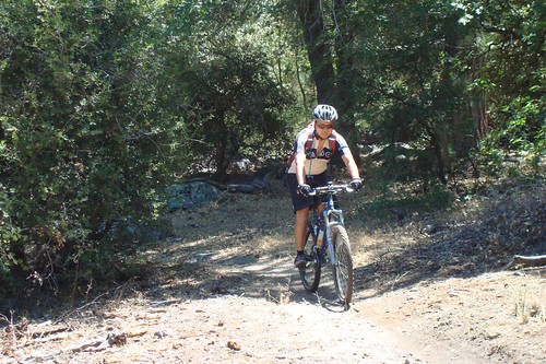
Tim & Jeremy riding the fireroad for four miles
WOW. It’s not often when something actually lives up to its billing, but the SART definitely did. Singletrack for 8 continuous miles, probably the longest stretch of uninterrupted singletrack I’ve ever done. SART, though, isn’t for the faint of heart though. During the 8 miles, we probably had some sort of exposure for at least 1/3rd of it. Exposure is both good and bad in that it makes the ride more technical, but has its dangerous aspect if we fell. It’s also great for getting some sweet vistas of the river and valley. Some of the exposure was VERY umm… exposed, like someone made the singletrack half as wide as normal and there was a sharp dropoff that left absolutely no room for error.

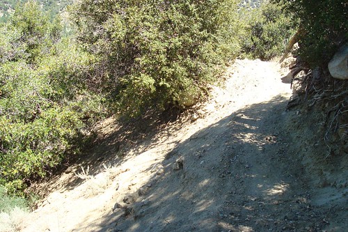
Eroding singletrack. Time to dab or walk… not time to do something stupid
Other times, the singletrack would drift away from the side of the mountain and we would find ourselves in a beautiful meadow dotted with trees. During these instances, we would open up the throttle and hammer along until we got into more exposed singletrack that required a bit more technical acumen and bike handling accuracy. Add in a few short climbs with baby head sized rocks thrown in for fun, some short descents going in and out of the forest, lots of blind turns and you basically had the 8 miles we rode. At the point where we turned off the trail I think all three of us stared longingly at more singletrack. This is definitely a trail we are going to hit up some more.
Part IV, some lessons learned and miscellaneous pictures that weren’t on the other posts.

I have done the ride from barton flats campground to the end of the trailhead that pops you out on a steep fire road climb out th highway 38. Lance and I also rode that trail in the winter ice on the road and snow on the ground that was a good ride accept for the piece of branch that broke my derailuer hanger clean off! I miss that trail!
Glad you guys liked the trail. It is a great one. We had to cut our ride short too. Nothing like mountainous singletrack to free the mind!
that’s really nice. Redwoods and running water. very nice.
“Baby head sized rocks…” HAHAHA! Why not softball sized or grapefruit sized? Ahh that made me laugh.
Waaay cool trail though, wish I was there! Great pics